Yellow snow warnings hit east Iceland, mountain roads turn hazardous for summer tires
- Yellow warnings begin at noon in Northeast Iceland and later in the afternoon farther east and in the central highlands.
- The Icelandic Met Office says snow will first affect higher passes before dropping to sea level by evening.
- Drivers on summer tires face hazardous conditions on mountain roads in the affected regions.
- The weather is expected to ease first in the northeast on Friday morning, and later in the east and central highlands on Friday evening.
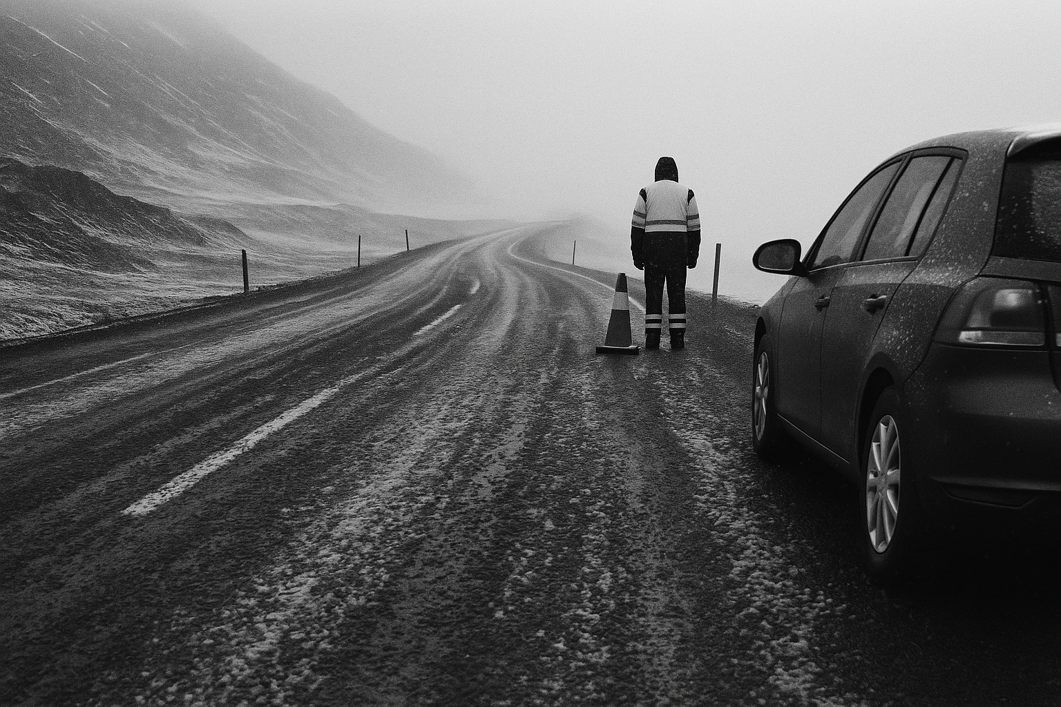
Yellow weather warnings will come into force across large parts of Iceland on Thursday as snow and cold air push into the northeast, east, the Eastfjords and the central highlands. RÚV reports that the first warning starts at noon in Northeast Iceland, with the others following later in the afternoon.
The Icelandic Met Office expects snow to begin on higher ground and mountain passes before the rain-snow line drops through the day. By evening, snow is forecast to reach sea level in the northeast and east. That matters most on the roads that connect settlements over elevated terrain: the warning itself points to hazardous conditions on mountain roads, especially for drivers who have already switched to summer tires. In late May, many motorists will have done exactly that.
The immediate divide is geographic. Southern Iceland is expected to get rain, while western parts of the country should see lighter precipitation. In the warning zones, temperatures are forecast to sit near freezing inland in the northeast, while the southwest remains much milder, with temperatures up to 12C. Friday brings more of the same pattern: sleet or snow in the north and east, rain in the south, and relatively little precipitation in the northwest.
The timing also points to different transport risks across the country. The weather is forecast to ease first in Northeast Iceland on Friday morning, but not until Friday evening farther east and in the central highlands. That leaves a full day in which roads over heathland and mountain stretches can deteriorate while lower-lying areas remain passable for part of the period. For sparsely populated regions that depend on long road links between towns, a yellow warning is less about spectacle than about whether school transport, deliveries and routine travel can proceed without interruption.
Wind speeds are expected at 5 to 10 metres per second from the northeast on Thursday, rising to 10 to 15 metres per second in the northwest and along the southeast coast. On Friday, northeasterly winds of 8 to 15 metres per second are forecast. Snow on the passes, near-freezing temperatures inland and cars on summer tires are usually enough on their own. This time they arrive together at the end of May.
Källor: RÚV